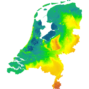
Hoogtekaart Nederland shows the elevation differences in the Netherlands. Find out which parts are below sea level or see how the rivers created our land.
The elevation maps are created by Rijkswaterstaat and the dutch waterboards for their use and are made available for free to the general public.