This is the latest release: 4.2.0
This application is the ultimate tool for planning complex trips with support for all major GPX-enabled navigation devices and smartphone apps. Information about stages and destinations of the next trip can simply never be collected in one place and combined into exciting routes. Thanks to the integrated SQL database, everything can be found quickly. Motorbike enthusiasts will find the best routes with KAKIMOTO, the ever-busy new cornering assistant.
With the integrated POI and hotel search you will find the best POIs and the most beautiful hotels. With 'POIs along the route', the integration of overnight stays becomes child's play.
The 'ConnectedRoutes' technology keeps the routes of several days together on long journeys. Long routes can easily be divided into travel days with 'TraveldaySplitting'.
In addition to advanced features such as 'AutoShaping' and 'AutoRouting', the integrated route planner also enables 'connecting routes' and 'preceding routes'. Individual routing parameters can be used for all sections of a route. A comfortable journey to and from the motorway, chasing curves with friends and a hike to a vantage point in between, all no problem.
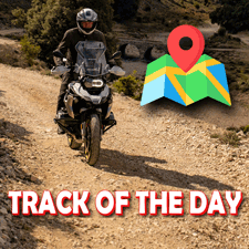
There are no restrictions for planning adventurous off-route trips.
By integrating Calimoto, Kurviger, TomTom myDrive, Komoot, and many other integrated route planners, ready-made tours can be imported and processed with one click. Planning with Kurviger or Calimoto, navigating with TomTom, Garmin or BMW Navigator, everything is possible.
Route planning has never been so efficient and easy. You can already see what awaits you on the way during the planning phase. This is made possible by the integration of Google Street View in the route planner. With the new 'RouteMetrics', the fun factor, curves, elevation profile and other important information are calculated in parallel during the planning phase.
No expensive map material needs to be purchased for this application. All maps are automatically updated and are available in many different languages. The route is calculated at the speed of light on a server farm with thousands of computers.
Tracks and routes can be created, visualized, analyzed and edited in GPX format. Routes can be transferred to navigation devices or smartphone apps with one click.
All tracks and routes can be sorted by name, date, distance, ride time, pace, altitude, etc. Tracks can be automatically colored by height or tempo.
Geocoded photos can be imported and converted to POIs.
With the Streetview integration, tracks and routes can be experienced virtually in the direction of travel. With just one click, any track becomes an animated MP4 video. Distance, time, speed, altitude and direction of travel are visualized in the virtual cockpit. At the same time, photos and POIs with photos or Google Street View images can be displayed.
The road type for sections of tracks can be marked and colored automatically. So markings like "Off-Road" etc. are possible.
The automatic clipping function reduces the data volume of very large tracks to half of the waypoints with just one click.
Refueling stops and small detours can be corrected with the integrated track editor. It is very easy to make tracks anonymous.
Tracks and routes can be shared in full or in sections as JPG graphics.
When exporting routes, limitations of the connected devices are automatically taken into account. POIs are automatically embedded in routes and displayed on the navigation devices.
Unencrypted POIs can be read from or sent to TomTom, Garmin and BMW Navigator. POIs can be exchanged between devices from different manufacturers.
TomTom users can transfer all routes to their devices in either GPX or ITN format.
The DOCX generator creates a practical road book from complex routes with POIs and photos with one click, the bpsw. can be edited and printed with Microsoft Word.
E-book authors will be pleased to know that all graphics are generated at 300 DPI and can be used immediately without the hassle of rework.